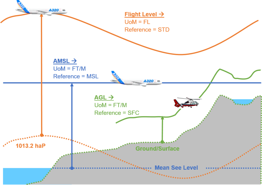
Above Ground Level
Height above ground level (AGL or HAGL) is a height measured with respect to the underlying ground surface. This is as opposed to height above mean sea level (AMSL or HAMSL), height above ellipsoid (HAE, as reported by a GPS receiver). In other words, these expressions (AGL, AMSL, HAE) indicate where the “zero level” or “reference altitude” – the vertical datum – is located.
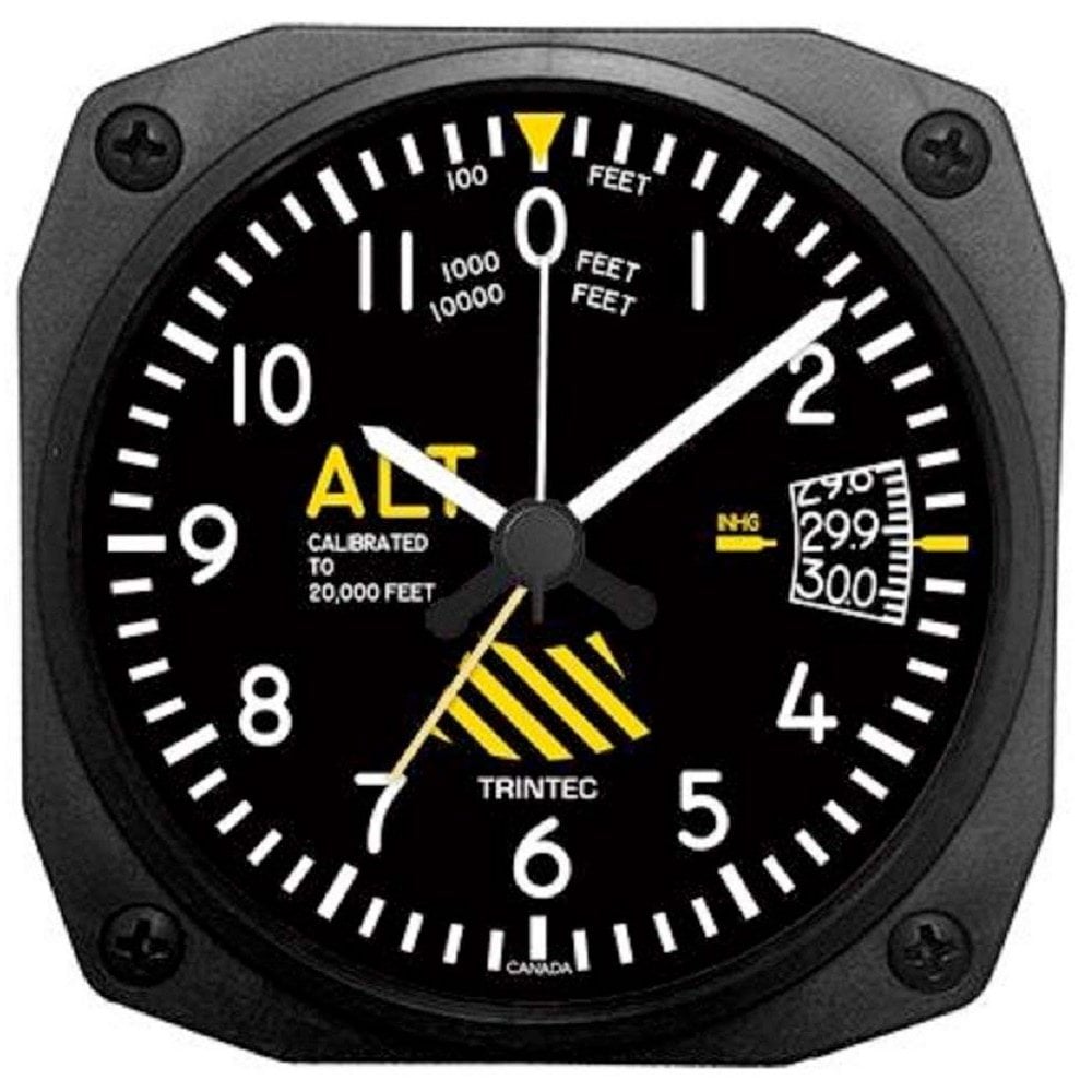
A pilot flying an aircraft under instrument flight rules (typically under poor visibility conditions) must rely on the aircraft’s altimeter to decide when to deploy the undercarriage and prepare for landing. Therefore, the pilot needs reliable information on the height of the plane with respect to the landing area (usually an airport). The altimeter, which is usually a barometer calibrated in units of distance instead of atmospheric pressure, can therefore be set in such a way as to indicate the height of the aircraft above ground. This is done by communicating with the control tower of the airport (to get the current surface pressure) and setting the altimeter so as to read zero on the ground of that airport. Confusion between AGL and AMSL, or improper calibration of the altimeter, may result in controlled flight into terrain, a crash of a fully functioning aircraft under pilot control.
While the use of a barometric altimeter setting that provides a zero reading on the ground of the airport is a reference available to pilots, in commercial aviation it is a country-specific procedure that is not often used (it is used, e.g., in Russia, and a few other countries. Most countries (Far East, North and South America, all of Europe, Africa, Australia) use the airport’s AMSL (above mean sea level) elevation as a reference. During approaches to landing, there are several other references that are used, including AFE (above field elevation) which is height referencing the highest point on the airfield, TDZE (touchdown zone elevation) or TH (threshold height) which both refer to the elevation of the landing end of the runway measured AMSL and AGL respectively.
In general, “altitude” refers to distance above mean sea level (MSL or AMSL), “height” refers to distance above a particular point (e.g. the airport, runway threshold, or ground at present location), and “elevation” describes a feature of the terrain itself in terms of distance above MSL. One mnemonic that can be used is: if it’s an altitude you can fly there, if it’s an elevation you can walk there, and if it’s height that’s how far a rock will fall before it hits the ground.